


AI-driven groundwater monitoring: Exploring cutting-edge technologies


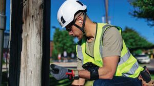
Groundwater is measured at the well, no matter how much of the monitoring happens from orbit. Satellites, radar, and airborne surveys read the aquifer indirectly, and AI turns those signals into forecasts worth investigating. Confirming a level or a contaminant still takes a technician with instruments, and that field record is what regulators are now asking for.
Key insights
Artificial intelligence (AI) paired with remote sensing technologies is transforming groundwater monitoring, giving teams a clearer view of conditions across extensive geographical areas. Water utility and field operations teams stand to benefit most, gaining new ways to enhance their monitoring and management capabilities.
Groundwater sits below the surface, so most monitoring technologies read a signal that stands in for it rather than reading the water itself.
Each method below captures something different: the shape of the aquifer, the ground settling above it, heat where groundwater surfaces, or the water level in a well. Making sense of them together is where AI earns its place.
Airborne electromagnetic (AEM) surveys send signals into the ground to image aquifer structure directly. For example, the U.S. Geological Survey (USGS) has flown AEM across the Mississippi Alluvial Plain since 2017 to map the aquifer beneath Arkansas, Mississippi, Louisiana, and Missouri. California recently completed its own statewide AEM program, covering 95 groundwater basins.
When an aquifer is pumped faster than it recharges, the ground above it can sink. Synthetic aperture radar can detect that sinking from orbit. USGS has mapped pumping-induced subsidence this way in California, Nevada, and Texas. And the NASA-ISRO Synthetic Aperture Radar mission (NISAR) can track vertical movement of about 0.4 inches over a plot the size of half a tennis court.
Unmanned aerial vehicles (UAVs) provide high-resolution images and can be rapidly deployed to collect data in specific locations. Those UAVs can also be equipped with sensors, including infrared cameras and lidar, to detect temperature variations and topographical changes. USGS scientists use thermal infrared cameras to locate focused groundwater discharge into streams, lakes, and wetlands, then use those images to choose where to sample directly.
Groundwater levels are still measured in wells. The USGS Active Groundwater Level Network alone covers more than 20,000 of them. Continuous data comes from instrumented wells that USGS transmits by satellite telemetry to the National Water Information System. AI algorithms analyze the remote sensing data alongside those well records, flagging changes that warrant a closer look.

One of the most significant advantages of AI-driven groundwater monitoring is its ability to integrate data from multiple sources. Combining sensor data, remote sensing information, and historical records creates a holistic view of groundwater conditions and trends. Integrated data helps teams understand the complex dynamics of groundwater systems, leading to more informed decision-making and effective management strategies.
For instance, data from weather stations, hydrological models, and geological surveys can be integrated with remote sensing data to provide a comprehensive understanding of groundwater recharge rates, flow patterns, and contamination sources. AI algorithms can analyze these diverse data sets, identifying correlations and trends that might not be apparent from individual data sources. Comprehensive analysis like this lets water utility and field operations teams make data-driven decisions, optimizing groundwater management practices and ensuring the sustainability of water resources.
Machine learning models trained on historical records and sensor inputs can forecast changes in groundwater levels, and some models now publish uncertainty alongside those predictions.
USGS used the Mississippi Alluvial Plain electromagnetic survey data to model groundwater salinity across the aquifer, which determines whether the water is usable for supply or irrigation. The results map where the prediction is likely or very likely to hold, rather than reporting a single number.
Sensors installed in wells can also catch sudden changes in turbidity or chemical composition, and AI can watch those streams for readings that look off. Even so, confirming a contamination event still requires a sample and a laboratory. U.S. Environmental Protection Agency (EPA) rules govern well placement, screen intervals, and sampling procedure so those samples represent actual aquifer conditions.

AI-driven groundwater monitoring also optimizes the allocation of resources. By prioritizing monitoring efforts and maintenance activities based on predictive analytics, water utility and field operations teams can allocate their resources more effectively. Prioritizing this way ensures efficient use of labor and equipment while reducing operational costs. For instance, AI can determine which areas are at the highest risk of contamination or depletion, allowing teams to focus their efforts where they are needed most.
Moreover, AI systems can identify areas that require immediate attention, preventing minor issues from escalating into major problems. Targeted attention like this extends the lifespan of groundwater infrastructure and reduces the need for costly emergency interventions. The cost savings and efficiency gains from AI-driven monitoring can be substantial, providing a strong return on investment for water utilities.
Oversight is tightening in some basins, and records are where it lands. For example, Arizona brought the Willcox Basin under active management in 2024 after water levels fell hundreds of feet, and non-exempt wells there now face measuring and reporting requirements. California put two San Joaquin Valley subbasins on probation the same year, shifting extraction reporting from local agencies to the state. Neither program asks for a risk score. They ask for measurements, taken at known wells on a known schedule.

Producing those measurements is field work. A Field Operations Management platform like Fulcrum handles that part. Crews measure water levels, purge and sample wells, log conditions, and record what they found. Every filing inherits the quality of that record. So does every model built on it.
Audio FastFill lets technicians speak a reading instead of typing it, which matters at a wellhead where hands are occupied and conditions are wet. Teams can then ask plain-language questions of that data with Fulcrum’s AI-powered Insights, including the extraction totals a state report requires. The record is the deliverable, whether it goes to a model or a regulator.
Researchers are testing pretrained AI models on groundwater prediction, which could save teams from building a new model for every basin. Early results are mixed. Groundwater moves slowly and behaves differently from one site to the next, so a model trained on one aquifer doesn’t necessarily work on the next one.
Instrumentation is expanding at the same time. The USGS Next Generation Water Observing System is testing new sensors in five basins and moving the ones that work into national monitoring networks. One line of work uses cosmic-ray neutron sensors to measure soil moisture across areas hundreds of meters wide, rather than the small patch a buried probe can reach. Denser networks mean more continuous data, which is what forecasting has been short of.
Groundwater monitoring now runs on two things that used to be separate. Satellites, radar, and geophysical surveys describe the aquifer from above, and AI finds patterns across data no analyst would combine by hand. Neither replaces a technician reading a water level at a wellhead, and that reading is what the rest depends on.
The teams getting the most from AI are the ones whose field records can support it. A forecast built on gaps is a guess with a confidence interval attached. Get the record right and everything built on top of it gets better, from the next forecast to the next filing.
See how Fulcrum helps your team turn field data into the accurate record your groundwater monitoring efforts depend on. Sign up for your free demo today to get started.
Learn more
Field operations demand flexible tools. Learn how low-code apps help teams build solutions quickly, improve accuracy, and streamline workflows.
Our white paper shows how field-first platforms reduce complexity, automate work, and connect data across systems.

Can satellites measure groundwater levels directly?
Satellites can’t measure groundwater levels directly. Instead, satellites read surface signals such as gravity changes, land subsidence, and soil moisture that correlate with groundwater conditions, but the water level itself is still measured at a well.
What is an airborne electromagnetic survey?
An airborne electromagnetic survey uses a helicopter-towed sensor that sends signals into the ground and reads what bounces back, producing an image of aquifer structure such as where sand, gravel, or clay sit underground.
Where has airborne electromagnetic surveying been used for groundwater mapping?
Airborne electromagnetic surveys have mapped aquifer structure since 2017, when the U.S. Geological Survey began flying them across the Mississippi Alluvial Plain. California has also completed a statewide program covering 95 groundwater basins.
Can AI detect groundwater contamination?
AI can flag anomalies in sensor readings, such as a sudden change in turbidity or chemical composition, but confirming an actual contamination event still requires a physical sample and laboratory analysis.
How accurate are machine learning forecasts of groundwater levels?
Machine learning forecasts of groundwater levels vary in accuracy depending on the aquifer, the density of available data, and how far into the future the forecast reaches, so they work best as a planning tool rather than a guarantee.
What causes land subsidence linked to groundwater?
Land subsidence linked to groundwater happens when an aquifer is pumped faster than it recharges, causing the ground above it to settle, a process that satellite radar can detect from orbit.
What is the NISAR satellite mission?
NISAR is a NASA-ISRO radar satellite, launched in July 2025, that can detect ground movement as small as roughly half an inch and revisits the same location every 12 days.
Does AI change what regulators require for groundwater compliance?
AI doesn’t change what regulators require for groundwater compliance. Regulators still require measured readings from identified wells on a set schedule. AI can help a utility organize and analyze that data, but it doesn’t replace the underlying measurement or reduce what has to be recorded.
How does groundwater monitoring differ once a basin comes under state intervention?
Groundwater monitoring is typically managed locally, with a utility or agency setting its own schedule and reporting practices. Once a basin comes under state intervention, the state instead sets specific wells, measurement methods, and reporting deadlines, and missing them can carry fees or penalties.
Why does field data quality matter for AI-driven groundwater monitoring?
In AI-driven groundwater monitoring, every forecast and every regulatory filing is built on the readings crews take in the field, so gaps or errors in that record limit what any model or report built on top of it can achieve.