


Stormwater management: Predicting flooding before it happens


Climate change and urbanization are straining stormwater infrastructure that engineers built for calmer weather. Forecasting tools, real-time monitoring, and data-driven analytics now add a critical layer on top of storm drains and retention basins, predicting flooding before it happens. Meteorological data, hydrological models, and machine learning work together to build that lead time. As AI, big data analytics, and green infrastructure mature, they’ll extend it further and help cities build real resilience.
Climate change and urbanization are compounding each other. Heavy precipitation events have been happening more often across the contiguous United States since the 1950s, overwhelming infrastructure built for calmer weather. At the same time, as cities expand, impervious surfaces like roads and buildings stop water from soaking into the ground, leaving nowhere for that extra rain to go. Cities now require proactive stormwater management that can handle both pressures at once.
Stormwater systems are catching up with the risk. Forecasting tools, real-time monitoring, and data-driven analytics now give municipalities a way to see flooding coming, not just react to it. That means crews can act before water hits the street, protecting infrastructure and the people who depend on it. Better data today builds the resilient systems cities will need for decades.
Storm drains and retention basins built for yesterday’s weather can’t keep up with today’s storms and sprawling development. Engineers designed them against NOAA Atlas 14, the federal precipitation frequency standard that assumes a stationary climate and is being replaced for that reason. Proactive stormwater management swaps static infrastructure for dynamic, adaptive strategies that manage runoff and stop flooding before it starts. Here’s what makes that shift essential:
Climate change adaptation. As global temperatures rise, heavy downpours are becoming more frequent. Intense storms can produce large volumes of water in a short period, overwhelming traditional drainage systems.

Urbanization. The expansion of urban areas increases the number of impervious surfaces, reducing the land’s natural ability to absorb water. This leads to higher runoff volumes and increased flood risk.
Infrastructure protection. Flooding can cause significant damage to roads, bridges, and buildings, leading to costly repairs and disruptions. NOAA counts 45 separate billion-dollar flooding disasters since 1980, averaging $4.5 billion a year. Proactive stormwater management helps protect these critical infrastructures.
Public safety. Floods pose a serious risk to public safety, causing injuries, fatalities, and displacement. NWS attributed 145 deaths to flash and river flooding in 2024. Early prediction and intervention can save lives and reduce the impact on communities.
Forecasting tools now combine meteorological data, hydrological models, and machine learning to predict flooding with real accuracy.
Rainfall intensity, duration, and distribution feed directly into flood predictions. Advanced weather radar systems and satellite imagery track storm patterns and precipitation in real time. That data builds detailed weather forecasts, which feed into hydrological models.
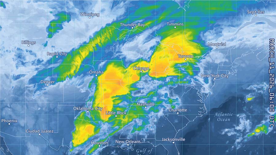
Hydrological models simulate how water moves through the environment based on soil type, topography, land use, and drainage networks, and they can predict how rainfall will translate into runoff and flag areas at risk of flooding. Combining that with meteorological data creates a more reliable stormwater management approach.
Trained on large historical datasets, machine learning algorithms catch patterns in flooding that traditional models miss and get more accurate the more data they see. By incorporating machine learning into stormwater management, cities get more precise and reliable flood forecasts.
In addition to forecasting tools, real-time monitoring plays a crucial role in proactive stormwater management. Sensors and IoT devices are deployed throughout urban areas to collect data on water levels, flow rates, and weather conditions.

Internet of Things (IoT) devices, such as connected valves, weirs, and stormwater pumps, enhance the efficiency of stormwater management systems. IoT devices can automatically adjust to changing conditions, such as opening or closing drainage gates to prevent overflows.
Data-driven analytics is the backbone of modern stormwater management. By analyzing data from various sources, cities can make informed decisions and implement effective flood prevention measures.
Predictive analytics uses historical data and machine learning to forecast flooding. Lead time depends on the type: the National Weather Service issues flash flood warnings minutes to hours ahead and river flood warnings hours to days ahead, giving agencies time to prepare and cut damage before it happens.
Geospatial analysis combines GIS data with hydrological models to create detailed flood maps. The maps show where flooding is most likely, helping authorities plan and prioritize mitigation efforts.
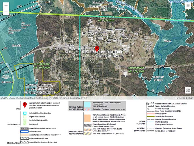
Risk assessment evaluates the potential impact of flooding on infrastructure, property, and public safety. By assessing the vulnerability of different areas, cities can allocate resources more effectively and implement targeted flood prevention strategies.
Cities will keep growing and climate change will keep intensifying, so proactive stormwater management will only become more important. Emerging technologies, including artificial intelligence, big data analytics, and green infrastructure, will further build on agencies’ ability to predict and manage flooding.
AI can analyze vast amounts of data and provide real-time insights into stormwater management. AI-powered systems can predict flooding in watersheds with no gauge record at up to five days of lead time, allowing for earlier warnings and mitigation of flood risks.
Big data analytics lets agencies pull together data from multiple sources, including weather stations, sensors, and field inspections, for a fuller picture of flood risk and better-informed decisions.
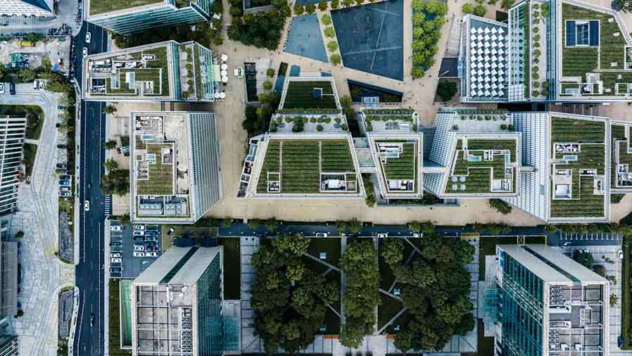
Green infrastructure, such as green roofs, permeable pavements, and rain gardens, can reduce the volume of runoff and enhance the resilience of urban areas. By integrating these features into city planning, municipalities can create sustainable and flood-resistant environments.
Proactive stormwater management protects cities from a growing flood risk. Forecasting tools, real-time monitoring, and data-driven analytics let cities predict and prevent flooding with real precision. Continued innovation here will decide which cities build the resilience to handle climate change and urbanization, and which don’t.
Storm damage doesn’t wait for paperwork to catch up. Fulcrum gives crews the tools to inspect infrastructure, log conditions, and close out work from the field, before, during, and after the storm. Connect with us today to see how Fulcrum keeps your stormwater systems ready for whatever’s coming.
What is proactive stormwater management?
Proactive stormwater management predicts flooding before it happens, instead of relying on fixed infrastructure to absorb runoff after a storm arrives.
Why can’t storm drains and retention basins handle today’s storms?
Storm drains and retention basins were engineered against precipitation assumptions from a stable climate. Heavier, more frequent rainfall and expanding impervious surfaces now regularly exceed the capacity those systems were built for.
What is NOAA Atlas 14?
NOAA Atlas 14 is the federal precipitation frequency standard used to size stormwater infrastructure. It assumes a stationary climate, and NOAA is replacing it with an updated standard called Atlas 15.
How do forecasting tools predict flooding?
Forecasting tools combine meteorological data from radar and satellite systems, hydrological models that simulate water movement through soil and terrain, and machine learning trained on historical flood events to identify risk before it materializes.
How does machine learning improve flood prediction?
Machine learning algorithms process large historical datasets to catch flooding patterns that traditional models miss. Their accuracy improves as they’re exposed to more data over time.
What is real-time monitoring in stormwater management?
Real-time monitoring uses sensors and IoT devices placed throughout urban areas to track water levels, flow rates, and weather conditions as they happen.
How do IoT devices help prevent stormwater overflows?
Connected valves, weirs, and stormwater pumps can automatically adjust to changing conditions, such as opening or closing drainage gates, without waiting on manual intervention.
How much warning do flash flood and river flood warnings give?
The National Weather Service issues flash flood warnings minutes to hours ahead, since flash flooding develops quickly, and river flood warnings hours to days ahead, since river flooding builds more slowly.
What is geospatial analysis in flood prediction?
Geospatial analysis combines GIS data with hydrological models to build detailed flood maps showing where flooding is most likely, helping authorities plan and prioritize mitigation work.
How will AI improve flood prediction in the future?
AI-powered systems can already predict flooding in watersheds with no gauge record up to five days ahead, giving agencies earlier warning than current methods provide.