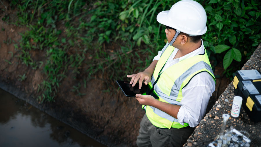
Environmental data management often breaks down at the handoff, where monitoring records pass through several hands before compliance review. Records reassembled in the office draw extra scrutiny during audits and permit renewals, and some gaps require another site visit to close. Capturing structure at the point of collection gives compliance leaders records they can defend from the start.
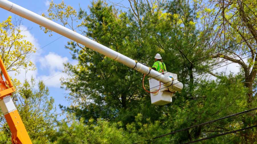
Vegetation is the most common cause of power outages in the U.S., accounting for more than 20% of incidents, and vegetation management is the number one line item on most utilities’ annual budgets. Spending at that scale comes with a reasonable question attached: what did the year’s work change. Field organizations run good programs and document them carefully, and answering that question still means inferring a good deal.

Every field organization has a list of workflows it decided not to build. Yours might have included confined space entry permitting, or a soil boring log that has to draw the layers, or a weld map that tracks non-destructive testing and coating status joint by joint down a pipeline run. Each one got looked at, considered, and set aside for a reason that made sense at the time.

Utilities manage vegetation across every mile of corridor they own, usually without a current picture of what’s growing into the lines. Work gets scheduled by calendar, so some spans get trimmed years early while encroachment builds somewhere nobody’s watching.

How AI-assisted development lets environmental firms encode their own processes into app extensions, data events, and custom reports — without a developer.

A regulated MS4 generates field records because its permit requires them, from outfall mapping through post-construction maintenance. Records held in separate, unlinked systems are difficult to turn into capital priorities or permit documentation. Consistent inspection forms tied to a GIS asset layer give a program one record feeding inventory, condition scoring, and capital planning. Federal rules already require permit terms to be clear, specific, and measurable, and records to be kept for at least three years. A program holding those records year-round has far less to reconstruct when a report comes due.

Water utilities have 60 days to identify and report storm damage to FEMA, and paper forms or verbal radio reports can leave that record built mostly on memory. Missing GPS coordinates, photos, and asset-level detail can put reimbursement at risk before that 60-day window even closes. Utilities running water utility management software before severe weather hits get a prioritized repair list, records that map cleanly to FEMA’s funding categories, and disaster recovery documentation built to stand up to federal review.

Every water utility faced the same LCRR deadline last October, but the results split fast. Utilities with a clean lead service line inventory verified pipe materials in the field before the crunch hit. Others defaulted unresolved lines to unknown and are still paying for it in notifications and lead service line replacement program queues. Here’s what separated the two groups, and what the 2027 LCRI deadline demands next.

Explore how Fulcrum eliminates manual handoffs, routes critical issues, and keeps projects moving.

Water utility asset inspections often lack reliable photographic evidence. That leaves organizations vulnerable during contractor disputes, regulatory audits, and insurance claims. Visual inspection software like Fulcrum addresses this gap by using automation to embed asset IDs, GPS locations, and timestamps into photos at the moment of capture. Inside Fulcrum, custom AI models can also flag defects like corrosion or cracking in that same photographic evidence. Together, they create a centralized, searchable visual history that integrates with existing utility systems and the broader inspection workflow to provide immediate, defensible proof whenever it is needed.

Water utilities inspect hydrants, valves, and meters constantly, yet these water infrastructure records remain among the hardest to verify. GIS, CMMS, and field inspection software are often implemented separately, leaving records scattered across systems that don’t talk. Connecting those systems into one record keeps condition assessment data current and turns audit requests from a scramble into a routine pull.

The EPA is speeding up delivery of several major water infrastructure funding programs, including the Drinking Water and Clean Water State Revolving Funds, the WIFIA loan program, and the Emerging Contaminants grant. Together, these programs direct federal investment toward water systems and projects that protect water quality and public health. Faster funding means a faster-arriving wave of permitting, inspection, and reporting work for the environmental consulting firms that support water utility clients. Here’s what that shift means for field teams, and why documentation readiness decides which firms absorb it smoothly.

Pipeline integrity teams manage corridors spanning hundreds of miles under strict federal repair deadlines. Connectivity gaps and crew expertise gaps compound the challenge in the field. Most software wasn’t built to handle scale, regulation, connectivity, and crew skill gaps together. Here’s what pipeline integrity software needs to deliver instead.

Field crews have always run infrastructure using software built for something else. Field Operations Management (FOM) names the missing category: running, recording, and closing out physical field work. This post covers the category, why existing tools fall short, and why Fulcrum is a Field Operations Management platform purpose-built for the field.

Explore calculation fields you control, location data that fills itself in, and hierarchical artifact classification built for fieldwork.

Getting project data to clients is one of the most tedious parts of the job for environmental field teams. Sharing what you find shouldn’t be a whole second job.

One of the things I hear most from environmental teams is that managing spatial data means juggling too many tools. You’re collecting in the field, then pulling coordinates into a separate GIS, then layering in reference data. Inevitably, things get messy somewhere in that handoff.

By Kristen Hazard Former CEO, Wildnote, Current Senior Director of Environmental, Fulcrum

AI is reshaping transmission and distribution fieldwork by aligning digital workflows with how inspections actually happen in the field. Applying artificial intelligence through practical AI inspection tools helps teams reduce documentation friction while improving the consistency of inspection outputs, inspection reports, and downstream asset records.

Explore Insights, a new AI-powered capability in the Fulcrum platform that turns raw field data into real-time answers. By enabling office teams to ask plain-language questions and receive instant summaries, maps, and charts, Insights removes delays and technical barriers from decision-making.

Agentic AI is poised to transform field operations by executing repetitive tasks autonomously, adapting to changing conditions, and reducing the need for human coordination. This evolution in agentic AI for field operations is built on decades of progress and now stands ready to address real-world challenges in industries like utilities, construction, environmental consulting, and others.

AI field data collection is the use of artificial intelligence to capture, structure, and act on data at the point of work, rather than after a crew returns to the office. In practice it means a photograph that classifies itself, a spoken observation that becomes a structured record, and a defect that is flagged while the inspector is still standing in front of it.

An environmental data collection app is a mobile tool that lets field teams record survey observations directly against a map. Surveyors can log soil, vegetation, water quality, wildlife, and pollution sources in one place as they work. GPS coordinates attach automatically, and validation rules check each entry before it’s saved.

GIS for AEC now shapes decisions across site selection, environmental compliance, urban planning, and infrastructure management. When AEC teams operate with accurate spatial data, risk drops, regulatory requirements become manageable, and field operations run more efficiently. The post gives AEC professionals a practical breakdown of where spatial intelligence creates measurable advantages across the full project lifecycle.

Groundwater is measured at the well, no matter how much of the monitoring happens from orbit. Satellites, radar, and airborne surveys read the aquifer indirectly, and AI turns those signals into forecasts worth investigating. Confirming a level or a contaminant still takes a technician with instruments, and that field record is what regulators are now asking for.

Climate change and urbanization are straining stormwater infrastructure that engineers built for calmer weather. Forecasting tools, real-time monitoring, and data-driven analytics now add a critical layer on top of storm drains and retention basins, predicting flooding before it happens. Meteorological data, hydrological models, and machine learning work together to build that lead time. As AI, big data analytics, and green infrastructure mature, they’ll extend it further and help cities build real resilience.

Water utilities face over $1.25 trillion in combined 20-year capital needs while managing strict federal mandates for lead, PFAS, and system resilience. Meeting these overwhelming infrastructure and regulatory demands requires transitioning away from error-prone paper processes toward structured digital field workflows. Dedicated Field Operations Management software connects point-of-work site observations directly to enterprise systems, ensuring full compliance and audit readiness.

Geospatial data is information connected to a specific location on Earth, such as coordinates, addresses, boundaries, assets, routes, imagery, or map layers. Teams use it to understand where things are, how they relate spatially, and what actions are needed in the field for inspections, infrastructure, environmental work, utilities, and planning.

Water utilities face compounding public health, regulatory, and financial pressures that leave no room for delayed laboratory testing data. Geographic Information System (GIS) technology bridges testing delays by providing a live, location-aware view of system conditions through continuous sensor integration and spatial modeling. Unifying these spatial insights with Field Operations Management platforms helps utilities quickly pinpoint contamination sources, optimize treatment processes, and maintain regulatory compliance from intake to tap.

Designing mobile data collection apps with intention helps teams capture cleaner, more valuable information in less time. When apps are focused and easy to navigate, data collectors work faster, and the results become easier to trust and analyze. Fulcrum’s platform combines a drag-and-drop interface and powerful form builder with geolocation capabilities, including GPS coordinates, custom maps, and geotagged photos. It works in a web browser or in offline data collection mode, so teams capture real-time data even without connectivity. These flexible tools support clarity, scalability, and stronger outcomes across every project. Teams evaluating the best field data collection app should look for smart forms, custom forms, offline forms, precise GPS location capture, media capture, and enterprise security that can support the complete field operations workflow.

Field data is information collected outside a traditional workplace — at a job site, along a utility right-of-way, in a wetland, at a point of transaction — rather than in an office or laboratory. It includes inspection results, sample readings, photographs, GPS coordinates and condition assessments, and it is usually captured by the person witnessing the thing being recorded.